
We are sad that we left the Amazon. The good news is that we transitioned back onto the gringo trail with some stops off the trail first.
The road between Macas and Riobamba is breathtaking, as we have found all Ecuadorian roads that link the jungle to the highlands. They all seem to skirt along cliff edges passing waterfall after waterfall through remote national parks, the only problem is we passed out cold this time after the change from 500 meters to 3800 meters elevation. My brain cannot process oxygen efficiently enough in those extremes. I may have even drooled.
Good news is I did see the lakes and paramo through the prettiest section of Sangay National Park before slipping unconscious! And when we arrived in Riobamba I felt quite refreshed.
H then took us on a (book) guided tour of the cute colonial section of town, in which we visited all of the grey areas on her map and made up interesting information about them.
Here we have a mural commissioned by the local Rotary club (we heart Rotary!)

Where the glorious history of modernization (while keeping your heritage in mind) is celebrated.
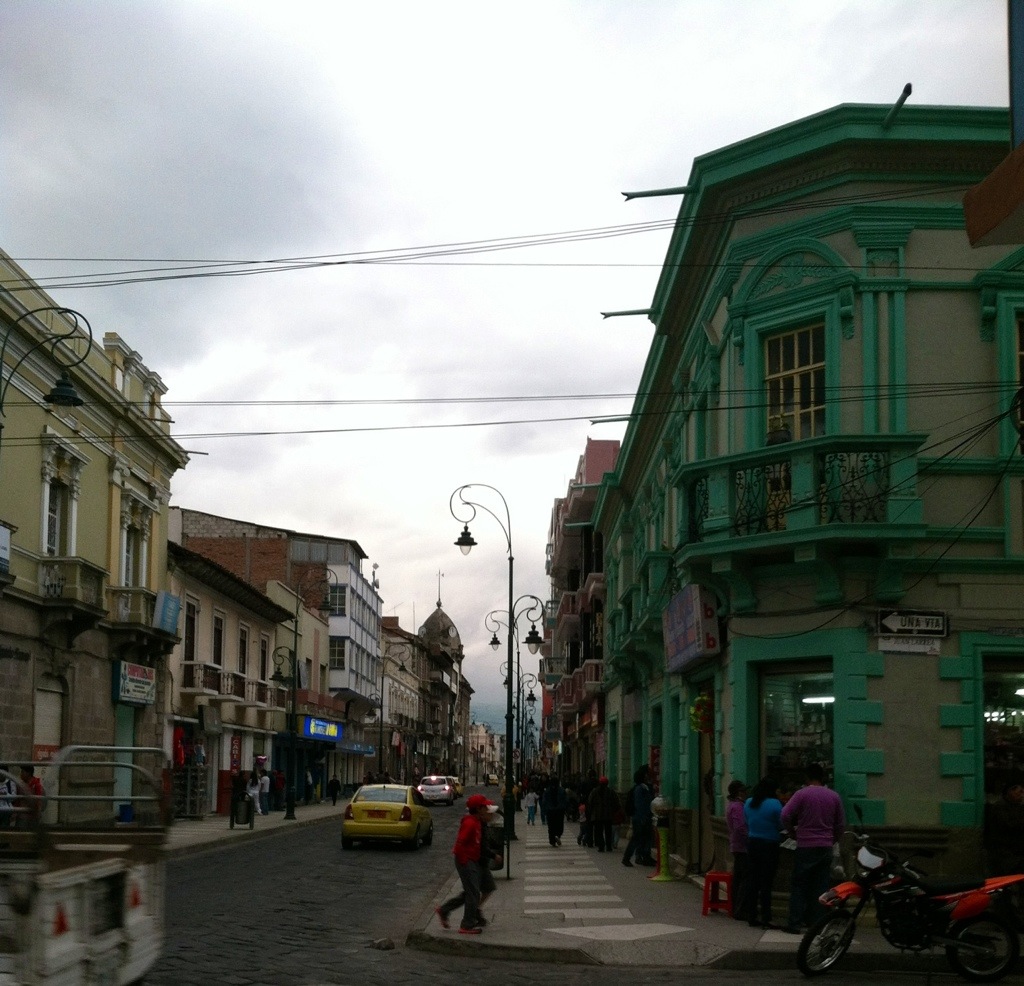
We greatly enjoyed the main plaza at Parque Maldonado, and it’s surrounding restored colonial buildings.

I enjoyed the guess where the volcanoes are game, where I point at particularly dark clouds and decide if there is a volcano lurking behind them. Ecuador is mostly cloudy so this game can be played anywhere in the highlands.
I had been particularly excited about the possibility of riding on La Nariz de Diablo train, which can start its trek here, but apparently only on Friday, Saturday, or Sunday. Also, it costs $25 per person for a 3 hour round trip ride… Out of our budget to get to the same place we started, unfortunately.
But no matter, we packed up and moved along the road to Guaranda, a cute little town just on the other side of the tallest point away from the earth (even including Everest, madness!). The road literally runs around the base of the massive Chimborazo (only 6310 m high) where llamas, alpacas, and vicuñas prance about freely.
The small town of Guaranda is nestled in between 7 hills and is so precious it nearly broke my heart. I don’t think many foreigners make it here, and it’s a shame (and also a blessing) because the views are picturesque and the locals are helpful and friendly.
Everyone wanted to help us find the way to climb to the statue of El Indio Guaranga, one of their local indigenous leaders.

In fact, the entire region is run by their indigenous people, and is such a peaceful and pleasant place to spend time! They grow their food in the hills about town, where we found the most adorable pigs.
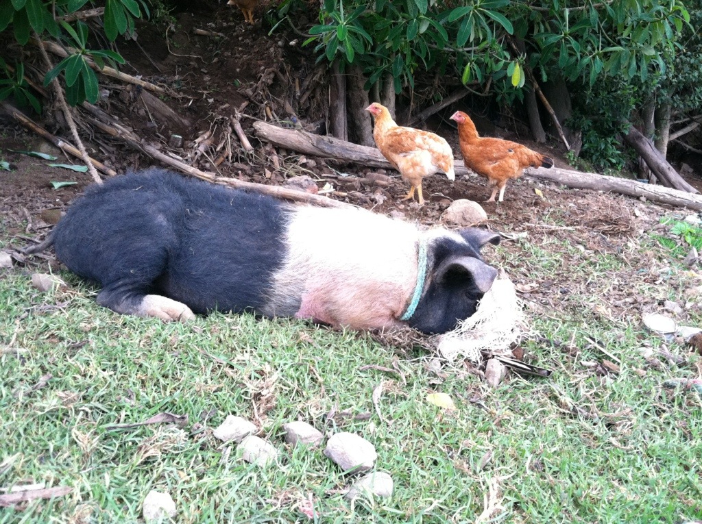
I was obsessed with watching them. So cute with his nose in a feed bag!
Then we headed higher into the mountains to find Salinas. An Italian monk chose this village to set up a cheese shop 30 years ago because it had the highest poverty rate in the country. He brought in a Swiss technician and now they sell their fair trade lactose products world wide. And it is so good… So, so, so good!
We bought pounds of cheese, yogurt, and butter and spent only $10 for the best dairy we have had in more than 11 months!
There also happens to be a local chocolate factory, where we bought one of every type of chocolate they made. Also, so good I may have cried a little.
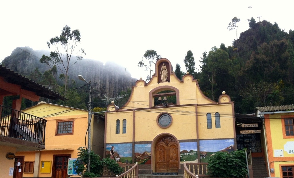
We lunched with the rest of town in front of the church on the main plaza
While the local kids played football, volleyball, and basketball and the adults chatted in various groups and the sun peeked in and out between clouds. The perfect afternoon!
Then we transferred along to Baños, to finish up some waterfalls we had missed when the family was here. We do not, as a rule, do so well coming back fully onto the gringo trail. It freaks us out to be around so many loud English speakers who don’t seem to do anything besides party and vomit.
Granted, there must be others like us mixed in there somewhere, but they are likely hiding out watching movies and hiking during the day, as we do.
After a failed discussion with our bus driver, we started our waterfall hike backwards. Instead of listening to where we wanted to go, he simply informed us that we would go where he thought we should, and he would let us know when we had arrived. Arguing was futile.
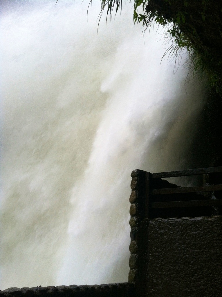
However, he took us to one if the most epic waterfalls I have yet had the pleasure to see, El Pailón del Diablo.
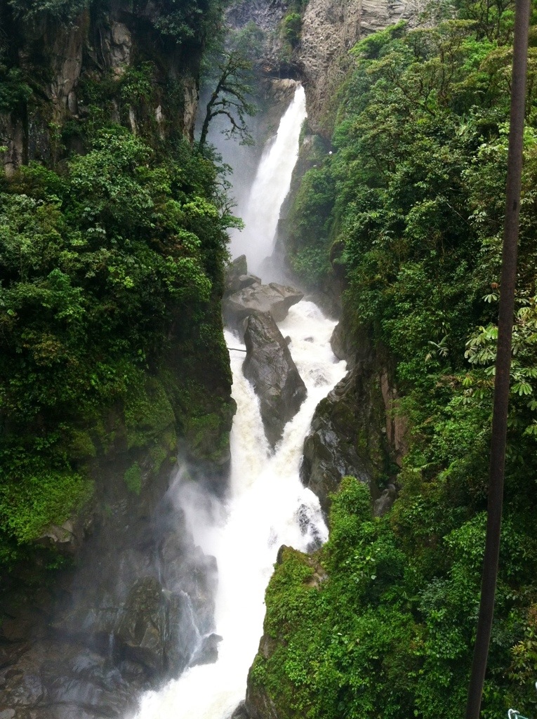
We had to pay $1.50 per person to enter, but their paths are extremely well maintained, with many different viewing platforms, and one where you can climb in a cliff/tunnel and stand right next to the epically powerful water
We then did the waterfall hike in reverse, since this was meant to be the endpoint. This also meant that our hike was entirely uphill, along a busy highway, in the rain.
So worth it! We saw many, many pretty falls and the elevation was pretty low so the drizzly rain was actually nice during the walk. The scariest part was at the end when we had to walk through the tunnel:

We survived, obviously (that’s H’s happy-survival face in case you didn’t know). And then moved north to finish our last bit of highland Ecuador!
